



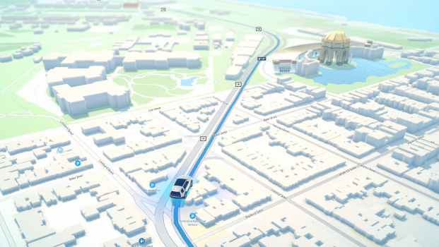
Once a go-to brand for GPS data TomTom is developing turning to knowledge management, adding contextual data and detail. Developed in-house by TomTom, ‘location intelligence’ technology gives organisations can gain key insights for geomarketing projects, such as optimising store locations or strategically placing billboards.
TomTom’s map data is generating increasing returns for the company. According to the company itself, it has stored 2.8 trillion kilometres of worldwide distance data and holds trillions of GPS points. In addition, it collects large volumes of up-to-date data from vehicles every day. These data are used for location intelligence and analytical models. Every time software is activated in a car from a manufacturer, the (anonymous) data are passed on to TomTom.
The foundation for this is TomTom Orbis Maps. Not simply a digital road map like the one you see in a navigation system, but a large, continuously updated database of location data. Orbis combines, among other things, OpenStreetMap, Overture Maps, TomTom’s own data, and data from vehicles and other sensors. TomTom says the platform now uses more than 5 billion data points to continuously enrich and verify the map.

For example, TomTom collects data on roads and road connections, lanes and lane markings, speed limits, traffic signs, and traffic restrictions without needing to use induction loops in the road.
Driving AI
Of course, such a map is not complete. There are plenty of older cars on the road that do not exchange driving data. But according to Willem Strijbosch, VP product, maps for navigation and automated driving, it is not necessary to capture all traffic flows. “Even with a handful of cars, it is already possible to determine where congestion occurs or traffic jams are building up.”
For autonomous driving, TomTom has, for instance, developed Orbis Lane Model Maps. These contain lane-level information, such as the exact geometry of lanes, connections between lanes and road markings.
That is actually the most interesting development. TomTom is trying to have Orbis function as a kind of spatial knowledge layer for AI. AI agents can use the map data to answer questions or carry out tasks in which location plays a role.
An AI agent could, for example, determine which stores lie within a given travel time from a location, which roads are affected by an incident, or which route is most suitable for a truck. TomTom has now also made Orbis APIs and an MCP server available for this purpose.
For years, specialised tools were needed to extract detailed location insights from these data. A GIS analyst could run a query, a planner could use a dashboard, and car manufacturers or fleet managers could deploy a web application. However, to find, analyse and use information, it was often necessary to combine multiple reports and systems. AI agents are changing that process.
There is an important difference between AI assistants and AI agents. AI assistants, such as TomTom AI Assistant (TAIA), work mainly at the front end of an application. AI agents are integrated much deeper into the architecture and can provide answers to complex questions. TAIA is an agent developed in-house by TomTom, while the Agent Toolkit ensures that agents from other parties can have access to spatial intelligence.
Users are given access to a ChatGPT-like environment where they can ask a wide variety of questions.
An insurer can, for example, ask which outstanding damage claims are located within 500 metres of a flood area from the previous night and at the same time fall within the insurance coverage area. A city planner can ask how estimated travel times around a central bridge have changed due to road closures and roadworks over the past six months. A planner at a transport company can instruct an agent to reroute commercial vehicles are stuck behind an incident on a motorway before their destination closes for business.
Emerce


 Ltd
Ltd