

Galwegians get new perspective on towns and villages with StoryMaps
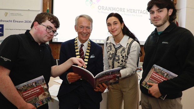
Students from the University of Galway are playing a key role in an innovative new digital project that brings County Galway’s unique heritage to life.
Spearheaded by Galway County Council in conjunction with Galway County Heritage Forum, The Heritage Council and local community and heritage groups, Galway County Heritage Trails showcases the cultural and historical significance of almost half of County Galway’s 4,556 townlands through meticulous research and the application of cutting-edge technologies.
One of the standout features of the project is the creation of StoryMaps, a series of interactive maps combining geographical data with multimedia elements to guide users through the historical landscapes of County Galway’s townlands, towns and villages.

In recent months, University of Galway students Dylan Reilly, Joseph Ennis and Natalie Cyrkle have been working with the Heritage and GIS teams of Galway County Council to convert historical data from sources, including O’Donovan’s Ordnance Survey Letters, Griffiths Valuation, the Down Survey, and the 1901 and 1911 censuses, into digital formats.
A total of 161 townlands in the civil parishes of Kiltartan, Kinvaradooras, Kilcolgan, Kilthomas and Killinny have recently been digitised while online StoryMaps also have been created for Oranmore, Mountbellew, Monivea and Ballyglunin, bringing to 2,000 the number of townlands now digitised through the project.
Cathaoirleach of Galway County Council Cllr Liam Carroll said: “StoryMaps is a simple yet powerful way to share information and enlighten, engage, and inspire people with stories that relate to locations of interest around us. Incorporating location and mapping into the context of a story, each StoryMaps is designed to provide an immersive experience, shedding light on the cultural and historical significance of various locations.
“Placements such as those with the Heritage Office allow students from the College of Arts, Social Sciences and Celtic Studies to develop important skills and broaden their horizons in terms of longer-term career options open to them. The positivity shown by students in their presentations in Áras an Chontae only serves to demonstrate the value of their experience in this project.”
Meanwhile, Galway County Council is inviting members of the public to contribute to Galway County Heritage Trails with the objective of digitising heritage information relating to all 4,556 County Galway townlands. To date, the Heritage Office has worked with community heritage groups, active retirement groups, Forum Connemara, Galway Rural Development, schools, University of Galway students, and The Heritage Council in digitising 2,000 of the County’s townlands.
“Making heritage more accessible to everyone is one of our main goals,” explained Marie Mannion, heritage officer with Galway County Council. “There are over 64,000 townlands in Ireland of which there are in the region of 4,556 in County Galway, Ireland’s second largest county. The townland is a uniquely Irish division and one of the oldest in existence. The boundaries of the townland have often been redefined to match borders with other divisions. It is the smallest notable division and is often the one with which people identify themselves.
“In addition to the academic aspect of the project, there is a strong emphasis on community engagement. Galway County Council and the students have worked closely with local heritage and community groups to collect and present local heritage information that enriches the content of the StoryMaps. This collaborative approach ensures that the digital heritage trails reflect the authentic voices and experiences of the community.”
Michael Mulkerrins, principal of Peterswell NS, whose 5th and 6th class students collaborated with the Heritage Office of Galway County Council on mapping the townlands of the civil parish of Kilthomas, said: “The children spent time studying our school maps to decide on what townlands they could visit and then it was decided that each student would photograph a small number of townlands. Students worked hard to find suitable points of interest to photograph in each townland and were thrilled to get the opportunity to visit every corner of our homeplace. Seeing their photographs now on the completed storyboards is fantastic recognition for our students.”
TechCentral Reporters


Subscribers 0
Fans 0
Followers 0
Followers