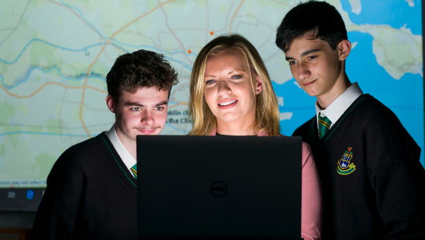
Esri Ireland makes €500m worth of digital mapping software available to schools
Geographic information systems (GIS) provider Esri Ireland is making €500 million worth of digital mapping software available to every primary and secondary school in the country.
More than 900,000 students in 4,000 schools will have access to Esri’s digital mapping platform, ArcGIS Online.
The platform allows students to collect, analyse and visualise data on a wide range of topics such as climate change, urban design and demographic trends.
The initiative has been rolled out by Esri in other countries across the world, including the UK, Canada, the US, the Netherlands, Germany, Spain, Portugal, Australia, and New Zealand. Students are applying the technology in a wide variety of ways and creating impactful GIS projects. For example, an Australian school recently mapped and developed solutions to alleviate local school traffic congestion, and students in Virginia have been using the technology to analyse police and fire coverage in four major US cities.
ArcGIS for Schools is already in use by 12 pilot schools located across Ireland, including a primary school and gaelscoil, and at a junior cycle, senior cycle and transition year level. Esri Ireland will provide a fully supported ecosystem consisting of hosted and managed infrastructure and continually updated local and global mapping data and content. Lesson plans aligned to primary and post-primary teaching and a GeoMentor programme, designed to connect mapping experts with local teachers, will also be provided.
Andrew Horan, geography teacher at pilot school St. Kevin’s College, Finglas, said: “The functionality and applicability of the ArcGIS application to so many different subjects means it has huge potential as a teaching tool. The support and resources provided by Esri Ireland have made it easy to implement, but most importantly, my students are really engaged with the technology. It’s simple to use and allows them to study topics in new ways, enhancing both teaching and learning in my classes.”
Joanne McLaughlin, Esri Ireland, said: “Through our work with the pilot schools we’re really encouraged by the reaction of both teachers and their students. Key to the successful adoption of the programme is the provision of support for teachers through workshops, lesson plans aligned to the curriculum, and a huge variety of online training resources. We believe this initiative can help address the evident STEM skills shortage in this country, by developing key spatial analysis, and critical thinking skills at a grassroots level.
TechCentral Reporters


Subscribers 0
Fans 0
Followers 0
Followers